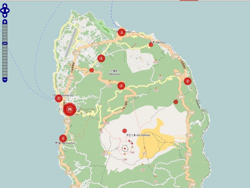
OpenStreetMap users volunteered their time to create a crisis map of Izu Oshima island [ja], a small island to the south of Tokyo where more than a dozen of people were killed by mudslides triggered by this week's deadly Typhoon Wipha. The red dots on the map represent reports submitted by users, which give information on things such as disaster relief, blocked roads, and water supply.
- English
- हिन्दी
- Ελληνικά
- Italiano
- Español
- Malagasy
- 繁體中文
- русский
- Français
- Română
- Português
- عربي
- українська
- Esperanto
- Nederlands
- 日本語
- srpski
- বাংলা
- Deutsch
- Filipino
- Aymara
- македонски
- bahasa Indonesia
- Shqip
- नेपाली
- ᱥᱟᱱᱛᱟᱲᱤ
- Magyar
- polski
- اردو
- Dansk
- ଓଡ଼ିଆ
- Igbo
- Yorùbá
- Swahili
- ਪੰਜਾਬੀ
- čeština
- فارسی
- Қазақша
- Türkçe
- 한국어
- Български
- Svenska
- Ўзбекча
- Català
- 简体中文
- አማርኛ
- كوردی
- မြန်မာ
- پښتو
- ⲛογπίⲛ
- עברית
- Tetun
- ភាសាខ្មែរ
See all those languages up there? We translate Global Voices stories to make the world's citizen media available to everyone.
Learn more about Lingua Translation »


3 comments