After Earthquakes, Nepal Faces Looming Danger of Landslides


Landslides in Sindhupalchok. Image by Deepesh Das Shrestha. Used with permission
It was predicted. After the 7.8-magnitude Great Earthquake on 25 April and the big aftershocks – 6.7 magnitude on 26 April and 7.3 magnitude on 12 May – the fragile hills have been vulnerable to landslides. Usually happening due to heavy rain during the monsoon season, Nepal has seen a series of landslides during the quakes and in the aftermath, the Kali Gandaki landslide being the latest.
That landslide, which ensued around wee hours on 24 May, was neither due to heavy rains nor a major earthquake. According to the Department of Hydrology and Meteorology, the slope, which was loosened by the earthquake and aftershocks, gave way with no apparent trigger.
Nepali Times editor Kunda Dixit tweeted:
Kali Gandaki landslide shows monsoon rains, major earthquake not needed to block Himalayan river Site is 100km west of April 25 #NepalQuake
— Kunda Dixit (@kundadixit) May 24, 2015
By the morning the blocked Kali Gandaki River had resulted into a landslide dam.
Nepal Police tweeted:
कालिगण्डकी थुनिन गई १५० मि. गहिराई, १ कि.मि लम्बाई, १०० मि. चौडाई पानिले डुबेको । खुलाउने पहल भैरहेको, कुनै मानबिय क्षति नभएको ।
— Nepal Police (@NepalPoliceHQ) May 24, 2015
150 meters deep, 1 kilometer long, 100 meters wide [piece of land] has blocked the flow of the Kali Gandaki [River]. Efforts initiated to drain the water, no human casualties reported.
Like in the earlier case of a massive landslide in Sindhupalchok last summer, where an engineer Kapil Dhital (@bewitchkapil) tweeted live from the site, Gokul Chhetri (@gocoolchhetri) tweeted live from the scene.
कालीगण्डकी थुनिएर पुरै तालमा परिणत भएको छ अझै पहिरो जान रोकिएको छैन। छिट्टै पानीको बाध फुट्ने संभावना छैन pic.twitter.com/y2Hhv6KB3I
— म्याग्देली भाइ (@gocoolchhetri) May 24, 2015
Kali Gandaki [River] has been blocked, turning into a lake. Landslide has not stopped yet. No immediate possibility of dam explosion.
यहि ठाउँ(बैसरी) हो जहाँ शुक्रबारको पहिले बिस्ताबितलाइ हिजो मात्र उद्दार गरिएको थियो तर आज त्यो ठाउ पुरै सकियो pic.twitter.com/XMLuCEReaJ
— म्याग्देली भाइ (@gocoolchhetri) May 24, 2015
This is the place (Baisari) where the displaced were rescued this Friday, but today this place is gone.
A high alert was issued and the 144 megawatt Kali Gandaki A Hydroelectric Power Station was shut down.
कालीगण्डकी ए को उत्पादन बन्द , ड्याममा उच्च सतर्कता pic.twitter.com/3FoPFLfN89
— Narendra K Shrestha (@NarendraDaju) May 24, 2015
[Electricity] production halted at Kali Gandaki A, high alert at the dam.
The landslide buried 25 houses in Baisari, but no deaths or injuries were reported. Given the possibility of the bursting of the landslide dam, the surrounding and seven districts downstream were asked to stay alert by the Flood Forecasting division of Department of Hydrology and Meteorology.
The imminent danger subsided when the water started flowing over the landslide dam after 16 hours.
अबस्था बिस्तारै सामान्य बन्दै। #धन्यवाद भगवान हामी लगाए हाम्रो बेनिलाई बचाइदिनु भएकोमा। pic.twitter.com/nCuLZDgvqg
— म्याग्देली भाइ (@gocoolchhetri) May 24, 2015
Condition slowly normalizing. Thank God for saving us and our Beni.
Beni Bazaar, a picturesque town located at the confluence of Kali Gandaki and Myagdi River, had been vacated at the onset of landslide.
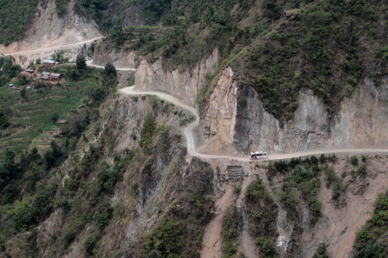
Landslides during and after the Great Earthquake
After the earthquake, 547 landslides have occurred in 19 districts, as reported by online portal Onlinekhabar.
The districts at high risk – Rasuwa and Gorkha – have witnessed 160 and 135 landslides, respectively. Similarly, Dhading and Sindhupalchok have had 77 and 62 cases of landslides.
A gruesome video of a landslide at Rasuwa posted online shows how dangerous the phenomenon can be.
Earlier, on the day of Great Earthquake on 29 April, the whole Langtang Village was washed away by a landslide killing all 200 inhabitants of the village.
Likewise, scores of people were buried in the earthquake induced landslide on the Araniko Highway, the road linking Kathmandu to Tibet.
A preliminary landslide susceptibility map created by Dr. Tom Robinson of University of Canterbury in New Zealand shows areas of greatest chance of landslide occurrence. They include major river valleys of Central Nepal – Kali Gandaki, Marsyangdi, and Trishuli Rivers as well as parts of Sunkoshi River catchment.
Likewise, a second map created by Dr. Rob Parker of Cardiff University says that landslides are also expected in the foothills, particularly north of Chitwan.
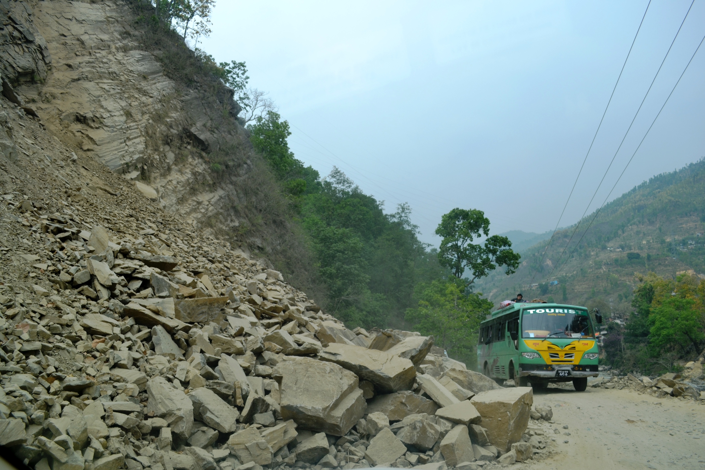
Landslide in Sindhupalchok. Image by Deepesh Das Shrestha. Used with permission
At these sites, there is constant fear of landslides blocking the rivers resulting into landslide dams. The dams while blocked are feared to cause inundation in the upstream and on bursting have the possibility of washing away the downstream communities.
The Landslide Blog advises monitoring the rapid change in the flow of all rivers and minimising risk by positioning a spotter at any landslide dam formed with a communications link to all villages downstream. It also suggests maintaining a clear protocol for communities to move to higher ground in case of a dam failure.
Abiding by these will not only make the residents living in the areas aware and alert but will also give ample time to communities living downstream to save themselves from flash floods.


